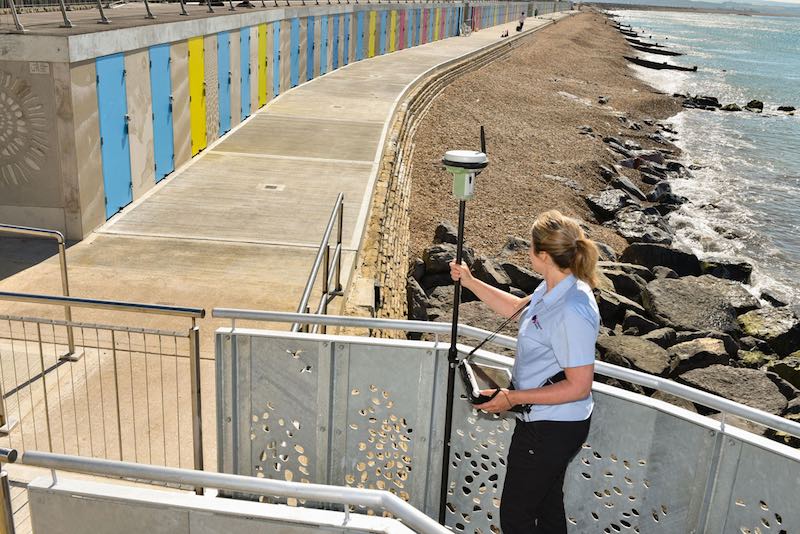
A stunning development of new beach huts on the south coast has been added to OS’s geospatial database ahead of the summer season.
The development, in Milford on Sea, replaces the old beach huts which were damaged and destroyed during a fierce storm on 14 February 2014. With building work on 119 beach huts and the surrounding area reaching a conclusion, it provided the ideal opportunity for our surveyor Joanne Lanham to officially capture and map the changes on the site.
Jo said: “This was a really interesting and quirky site to survey, making a change from day to day surveying of new homes and road layouts. Following the storm in 2014 we updated the OS database by removing the old huts, and now we are pleased to be adding these new ones. This was a bigger survey than I imagined with a lot of changes and improvements to the location. It is great to see the new huts in place and the day was made even more special as the sun decided to shine!”
The site survey took around half a day and included changes to the beach huts, promenade, walkways and car park. The new beach huts also have a special OS link with the installation of breath-taking concrete artwork panels between the colourful beach hut doors. Visitors to the Milford on Sea beach huts will see panels displaying OS mapping of the area including the Isle of Wight.
Jo added: “The OS design on the panels look fantastic. They’re subtle and intricate, and I think people will spend as much time staring at them as they will staring out from the huts to sea!”
Every day thousands of updates and amendments are made to Britain’s geospatial database, which contains over 500 million geographic features. We have a team of 270 surveyors, supported by aerial imagery, to survey and map the changing face of the nation. Using the latest GPS technology, our surveyors can map to centimetre accuracy, ensuring that Great Britain remains one of the most accurately mapped nations on the planet.

