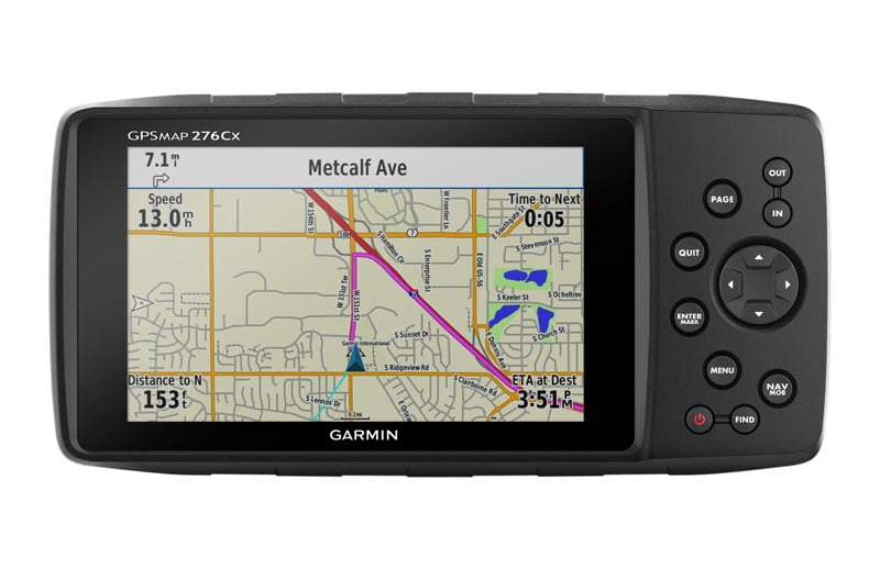
Garmin announces the GPSMAP 276Cx, an upgraded reinvention of the classic 276C. Since its launch in 2004, the 276C has proven in countless deployments all around the world to be Garmin’s most versatile all-terrain GPS navigator, ready for land and sea. The 276Cx provides the well tested classic functionality of the original, with all the latest technological improvements of the last decade in a device truly as unique as the customer who desires such performance. The 276Cx now features both GPS and GLONASS for better performance in heavy cover, optional external antenna support (sold separately), HotFix for faster satellite acquisition and other wireless connectivity features. For improved operation in demanding environments, there’s now a larger sunlight-readable 5-inch display as well as a barometric altimeter and 3-axis compass, which were not present in the 276C.
“We’re excited to introduce a fresh and versatile update to the classic all-terrain navigator with the GPSMAP 276Cx,” said Martin Resch, Senior Product Manager Outdoor EMEA. “Back by popular demand, and updated to fit the 2016 user, the GPSMAP 276Cx can handle anything users want to put it through, no matter if they are out on the water, hitting the trails or simply cruising.”
The new display, familiar push-button controls, and the well-known highly customisable user interface makes the GPSMAP 276Cx as versatile and safe to use as its predecessor. There are a variety of rugged mounting options, and with an IPX72 water rating, it’s ready to withstand the elements. Another upgrade to the classic design is the new dual battery system, which is compatible with the rechargeable Li-Ion battery pack (included), traditional AA batteries (sold separately) and several powered mount options (powered AMPS compatible mount included). The 276Cx can get up to 16 hours of battery life with the rechargeable battery, and up to 8 hours with AA batteries.
The GPSMAP 276Cx comes preloaded with the Recreational Map Europe, a worldwide basemap with shaded relief, and a free subscription to BirdsEye Satellite Imagery to see real-life terrain views right on the device. Additionally, the GPSMAP 276Cx is compatible with a variety of optional maps including: Garmin TOPO maps, BlueChart® g2 HD marine charts, Custom Maps and raster maps. For enhanced navigation convenience it also features turn-by-turn and Curvy Routes routing with text-to-speech voice guidance on City Navigator® and routable Topo Maps. The device’s 8 GB of internal memory can also be expanded using a microSD™ card (sold separately).
The GPSMAP 276Cx also boasts a variety of new connected features. Using Wi-Fi® or when paired via Bluetooth to the Garmin Connect™ mobile app on supported devices, the 276Cx delivers Active Weather forecasts and animated weather tracking on the map page so users can always be aware of the current weather conditions. Additional app connected features include automatic uploads, smart notifications, LiveTrack and more. The 276Cx also supports ANT+® for external sensor integration, Bluetooth® headsets for voice guidance during navigation and Wi-Fi® for automatic updates. The GPSMAP® 276Cx is available from £649.99 and will be available in October 2016.
The GPSMAP 276Cx is the latest solution from Garmin’s expanding outdoor segment, which focuses on developing technologies and innovations to enhance users’ outdoor experiences.

